


Precinct 1072, Clark County, Nevada
About
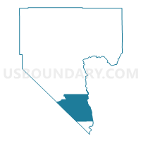
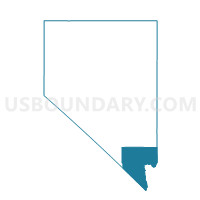
Outline

Summary
| Unique Area Identifier | 614575 |
| Name | Precinct 1072 |
| County | Clark County |
| State | Nevada |
| Area (square miles) | 671.09 |
| Land Area (square miles) | 651.31 |
| Water Area (square miles) | 19.78 |
| % of Land Area | 97.05 |
| % of Water Area | 2.95 |
| Latitude of the Internal Point | 35.43053290 |
| Longtitude of the Internal Point | -114.84074940 |
Maps

Graphs
Select a template below for downloading or customizing gragh for Precinct 1072, Clark County, Nevada


Neighbors
Neighoring Voting District (by Name) Neighboring Voting District on the Map
- Voting District 11160, San Bernardino County, CA
- Davis Dam Voting District, Mohave County, AZ
- Dolan Springs Voting District, Mohave County, AZ
- Precinct 1073, Clark County, NV
- Precinct 1074, Clark County, NV
- Precinct 1535, Clark County, NV
- Precinct 1542, Clark County, NV
- Punto De Vista Voting District, Mohave County, AZ
- White Hills Voting District, Mohave County, AZ
Top 10 Neighboring County Subdivision (by Population) Neighboring County Subdivision on the Map
- Clark CCD, Clark County, NV (179,324)
- Kingman CCD, Mohave County, AZ (66,268)
- Bullhead City CCD, Mohave County, AZ (65,938)
- Newberry Springs-Baker CCD, San Bernardino County, CA (12,696)
Top 10 Neighboring Place (by Population) Neighboring Place on the Map
- Bullhead City city, AZ (39,540)
- Laughlin CDP, NV (7,323)
- Searchlight CDP, NV (539)
- Cal-Nev-Ari CDP, NV (244)
Top 10 Neighboring Elementary School District (by Population) Neighboring Elementary School District on the Map
Top 10 Neighboring Secondary School District (by Population) Neighboring Secondary School District on the Map
Top 10 Neighboring Unified School District (by Population) Neighboring Unified School District on the Map
Top 10 Neighboring State Legislative District Lower Chamber (by Population) Neighboring State Legislative District Lower Chamber on the Map
- Assembly District 34, CA (487,193)
- State House District 3, AZ (216,687)
- Assembly District 20, NV (58,569)
Top 10 Neighboring State Legislative District Upper Chamber (by Population) Neighboring State Legislative District Upper Chamber on the Map
- State Senate District 18, CA (1,048,811)
- State Senate District 3, AZ (216,687)
- Clark County Senatorial District 12, NV (214,362)
Top 10 Neighboring 111th Congressional District (by Population) Neighboring 111th Congressional District on the Map
- Congressional District 3, NV (1,043,855)
- Congressional District 2, AZ (972,839)
- Congressional District 2, NV (836,562)
- Congressional District 41, CA (797,133)
Top 10 Neighboring Census Tract (by Population) Neighboring Census Tract on the Map
- Census Tract 9514.02, Mohave County, AZ (4,036)
- Census Tract 9504.02, Mohave County, AZ (3,950)
- Census Tract 103, San Bernardino County, CA (3,846)
- Census Tract 57.05, Clark County, NV (2,206)
- Census Tract 9505, Mohave County, AZ (1,446)
- Census Tract 57.03, Clark County, NV (1,440)
Top 10 Neighboring 5-Digit ZIP Code Tabulation Area (by Population) Neighboring 5-Digit ZIP Code Tabulation Area on the Map
- 86413, AZ (12,103)
- 89029, NV (7,546)
- 86429, AZ (7,162)
- 86441, AZ (2,224)
- 89046, NV (660)
- 89039, NV (316)
- 92364, CA (90)